

Stunning images from space reveal the shocking extent of Australia's bushfire crisis
3848
Saturday, 04 January, 2020, 05:05
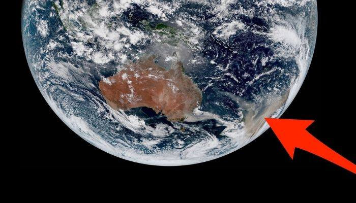 Australia's raging bushfires are so bad that satellites thousands of miles above Earth can easily spot their flames and smoke from space. The fires likely started naturally, though experts think human-caused climate disruption has exacerbated hot arid conditions that fuel the growth of such blazes. Current estimates suggest eastern Australia's bushfire crisis has scorched more than 14 million acres of land, killed about half a billion animals, and displaced hundreds of thousands of people. The photo above — which shows plumes of smoke about half the area of Europe darkening skies as far as New Zealand in a yellow haze — was taken on Thursday by the Japan Meteorological Agency's Himawari-8 satellite. 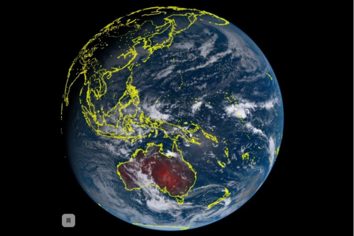 |

‘Once-in-a-lifetime chance’: Japan launches historic mission to collect rocks from Mars’s moon Phobos
41420.10.2026, 22:54
Evidence for funerary behaviour and lethal trauma in a new Neanderthal individual from Shanidar Cave (photo)
93817.10.2026, 00:30
Stone Age sites identified in Uzbekistan’s Jizzakh region
65211.10.2026, 16:24
Nobel physics prize awarded for detection of cosmic neutrinos
81606.10.2026, 19:12
Archaeologists uncover monumental Etruscan tomb filled with rare treasures at ancient Vulci
73904.10.2026, 17:00
Gene-edited bananas that don’t go brown could hit UK supermarkets
77129.09.2026, 20:13